Cintheaux, Gaumesnil and Saint-Aignan-de-Cramesnil, three otherwise obscure small hamlets in Normandy located alongside the Route Nationale 158 approximately sixteen kilometres south of the city of Caen, would be relatively insignificant locations in the history of the Second World War, were it not for the events that would take place there on August 8th 1944 during Operation “Totalize”. On this date a skirmish between Michael Wittmann’s team of Tiger Is and an unknown enemy would take place, resulting in the Leibstandarte Panzer ace’s untimely death.
How to get there
While Cintheaux is well signposted, both Gaumesnil and Saint-Aignan-de-Cramesnil are very small places – blink when travelling down the RN 158 and you might miss them. Wittmann’s Tiger and three others would be lost in the area between the two hamlets, so to get a good feel of the lie of the land it would be a good idea to set down in one and take a walk to the other. As the Panzers would head north from Cintheaux – just south of Gaumesnil – this should be your starting point.
[ready_google_map id=’2′]
Getting to Gaumesnil from Caen is a little complicated, as there is no direct turning off the southbound RN 158. Following the signs to Cintheaux, exit at “La Jalousie” onto the D 23A. At the next main junction, take the first left and then continue to the D 80 heading north. At this point make an 180 degree turn back towards Cintheaux on the D 183A, which runs parallel to the RN 158. After seeing the Bretteville-sur-Laize Canadian cemetery on your right, turn right at the next junction onto the D 183, taking you across the RN 158 into Cintheaux. Head north up the Rue du Prieuré (D 167) before taking the next left turn at Rue de la Malle Poste. At the next junction turn right into Rue de Gaumesnil, where you will see the entrance to the Canadian cemetery which is a good place to park.
From Falaise and the south, head north towards Caen on the RN 158 and exit at the junction “Cauvicort”, where you will enter a bend taking you almost back on yourself. At the junction with the D 132A turn left, and then after around 100 meters take the next left onto the D 183A towards Cintheaux which runs parallel to the RN 158. Travel north for 1.8 kilometres, and at the next major junction with the D 183 turn left towards Cintheaux before turning right onto the Rue du Prieuré (D 167) as above.
[youtube=http://www.youtube.com/watch?v=jF_2nv5gS3w&w=640&h=360]
Heading towards St. Aignan de Crasmenil on the D 183A out of Cintheaux, with the fields on the right where Wittmann’s Tiger would be destroyed on August 8th 1944. In the distance you can see the “Orchard”, where the 1st Northants Yeomanry were situated
Details
There is nothing in the area to indicate what happened some seventy years ago, and here you will need to use your maps and guides to find your way to the approximate spot where Michael Wittmann’s Tiger I would see its final action. The famous last known photograph of the tank would place it a short distance from the RN 158 east out of Gaumesnil, and it was in this general vicinity where the bodies of Wittmann and his crew would be discovered in 1983 when the road was being widened.

For close to forty years the bodies of Wittmann and his crew would rest in this place before being transferred to the German military cemetery at La Cambe.
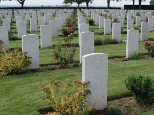
Having followed the trail of the Tigers and made your way back to your starting point, a visit to the Canadian cemetery is recommended. Among those buried here are soldiers from the Sherbrooke Fusilier Regiment, one of the many Allied formations who would encounter the Tigers on that fateful day.
Address
Gaumesnil, Cintheaux, Basse-Normandie, France
49.05529 N, 0.289814 W


